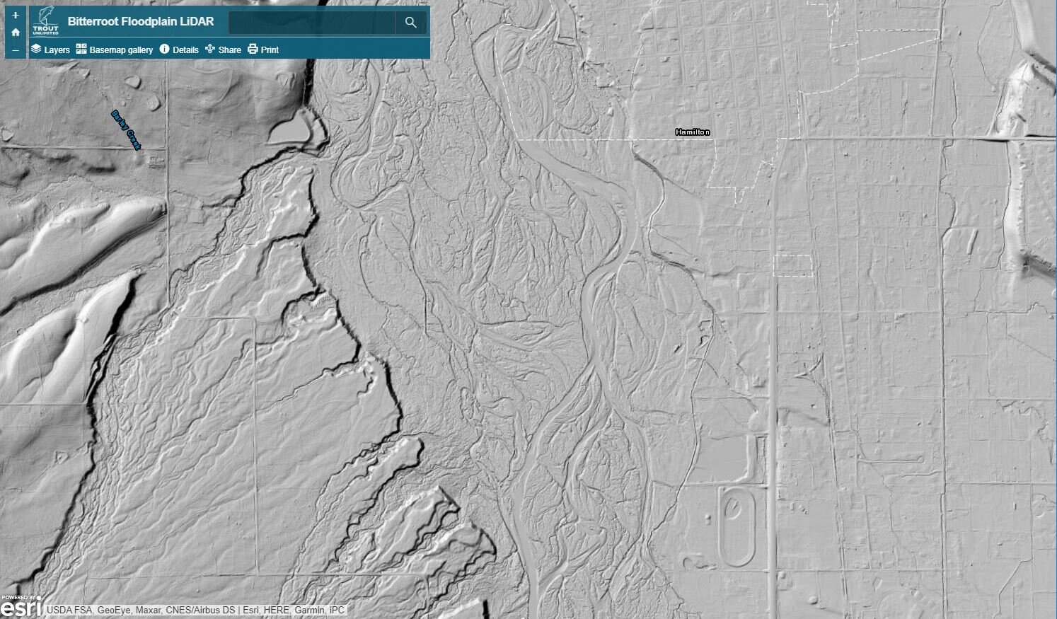

Bitterroot Drainage LiDAR
This amazing new interactive map of the Bitterroot floodplain was developed by Christine Brissette, Special Projects Manager for Trout Unlimited, in collaboration with Trout Unlimited and Bitterroot Chapter of Trout Unlimited. This map was created with LiDAR (light detection and ranging) data, a technique that uses an aircraft-mounted laser to survey large landscapes at a very fine scale. The LiDAR survey was completed by the Ravalli County Planning Department between 2008-2013. Trout Unlimited then worked with Montana State Library to convert the survey data into an online, interactive map.
The detail of LiDAR maps reveal different things to different people. In it, you can see the paths the Bitterroot River has taken in the past, where it is going and how these natural migrations of rivers and streams influence (and sometimes conflict with) human development like roads, agriculture or towns. For trout lovers, it provides a new perspective on our favorite fishing spots, and unique blueprint for identifying and designing restoration projects.
To find a specific location, use the "Search" line at the top. You can also click on the "Layers" tab and uncheck the "Bitterroot Floodplain Hillshade" layer which will display a basemap below.